Goslar
UNESCO World Heritage imperial city in the Harz Mountains, medieval center built on 1,000…

Lower Saxony, known in German as Niedersachsen, is a federal state in northwestern Germany that stretches from the North Sea coast to the Harz Mountains. It covers about 47,700 square kilometers, making it Germany’s second-largest state by area after Bavaria, and it is home to roughly eight million people.
The British military government created the state in 1946 by merging the former Province of Hanover with Oldenburg, Brunswick, and Schaumburg-Lippe. That administrative act brought four regions with separate histories, dialects, and food traditions into one federal state.
Lower Saxony is the only German state that contains both a tidal sea coast and a mountain range, so a traveler can walk the Wadden Sea mudflats and ski near the Wurmberg summit on the same trip. That range helps explain why itineraries here vary so much from one corner to another.
Understanding how East Frisia, the Hanover region, Brunswick, and the Harz differ helps travelers choose a base, season, and route that suit what they want to see.
Lower Saxony occupies Germany’s northwestern corner. The state borders the North Sea in the north and reaches south to the Harz Mountains.
Most of its territory lies on the flat North German Plain, while the southern quarter rises into low, wooded hills.
The state’s northern edge meets the North Sea along roughly 780 kilometers of coastline, including islands, bays, and river mouths. Behind the dikes, marshlands, drained moors, and farmland stretch inland.
Moving southeast, the land climbs. The Lüneburg Heath forms a sandy, gently rolling belt in the northeast, while the Weser Upland and western Harz farther south create the state’s only true highland terrain. The Wurmberg reaches 971 meters.
Lower Saxony touches more neighbors than almost any other German state. It borders the Netherlands to the west and nine German territories in total.
| Direction | Neighbors |
|---|---|
| West | Netherlands, North Rhine-Westphalia |
| North | Schleswig-Holstein, Hamburg |
| East | Mecklenburg-Vorpommern, Brandenburg, Saxony-Anhalt |
| South | Thuringia, Hesse |
The city-state of Bremen sits as an enclave inside Lower Saxony’s territory. Three rivers organize the landscape: the Ems in the west, the Weser through the center, and the Elbe along the northeastern border.
Hanover governs Lower Saxony, and the Landtag, or state parliament, meets there. The parliament elects the Minister-President, who leads the state government.
The state controls schools, policing, and much of its transport planning. Its infrastructure includes major rail junctions at Hanover and inland waterways such as the Mittelland Canal and the Dortmund-Ems Canal, which carry freight between the Ruhr, North Sea ports, and eastern Germany.
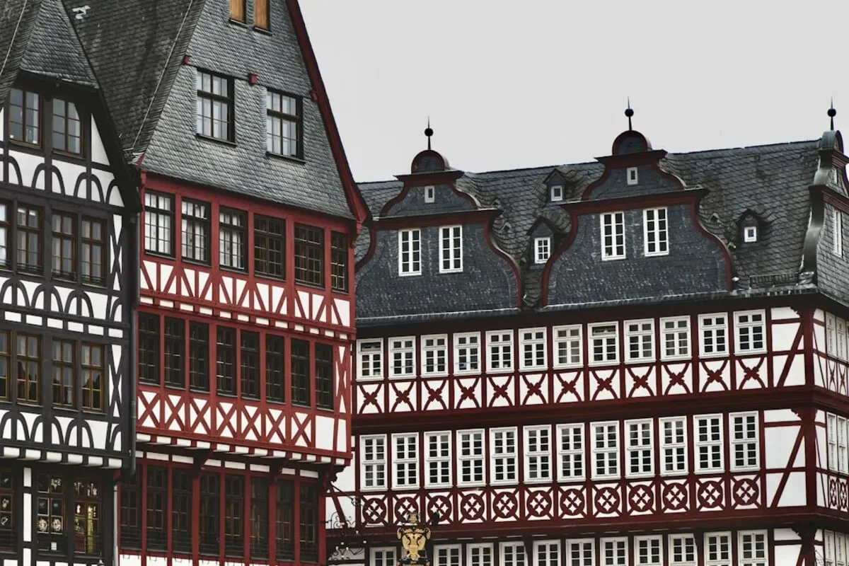
Lower Saxony’s urban network runs from Hanover, a trade-fair and rail hub of about 545,000 residents, through half-timbered towns like Celle and Goslar to industrial Wolfsburg. Three UNESCO World Heritage Sites sit within the state’s towns: the Rammelsberg Mine and old town of Goslar, the cathedral and St. Michael’s Church in Hildesheim, and the Fagus Factory in Alfeld.
Hanover is the capital and largest city, at the center of the Hanover Region administrative district. It serves as the most important road and rail junction in northwestern Germany.
The city is known for its trade fairgrounds, Herrenhausen Gardens, and a rebuilt center that reflects heavy wartime damage. Travelers can reach Hamburg, Berlin, and Frankfurt from Hanover Hauptbahnhof in under three hours.
Celle preserves around 400 half-timbered houses and a ducal palace. It escaped serious bombing damage. At the northern edge of the Harz, Goslar grew wealthy on silver from the Rammelsberg Mine, and both the mine and old town hold UNESCO World Heritage status.
Hildesheim has a separate UNESCO listing for St. Mary’s Cathedral and St. Michael’s Church. Both churches are Romanesque, and both were reconstructed after 1945.
Lüneburg built its fortune on salt and joined the network of Hanseatic cities. Its brick gabled houses and tilted streets reflect subsidence caused by centuries of salt extraction beneath the town.
Stade, west of Hamburg on the Elbe, retains a restored Hanseatic harbor basin and timber-framed warehouses.
Braunschweig (Brunswick in English) was the seat of Henry the Lion and the historic center of the Brunswick Land. Its landmarks include a Romanesque cathedral and a bronze lion statue on the Burgplatz.
Göttingen is a university town whose graduates include dozens of Nobel laureates. In the west, Osnabrück hosted part of the negotiations that ended the Thirty Years’ War in 1648. Oldenburg served as the capital of a grand duchy and still has a palace, a state museum, and a compact pedestrian center.
Wolfsburg was founded in 1938 as a factory town for Volkswagen and remains the company’s global headquarters. The Autostadt, a visitor complex beside the plant, presents car design, brand pavilions, and vehicle delivery towers. It attracts travelers who might otherwise skip the region’s industrial north.
The state’s landscapes fall into four broad zones: the East Frisian coast and islands, the Wadden Sea tidal flats, the inland heath and moor country, and the southern uplands. Each supports different outdoor activities, from tidal walking in the north to winter sports on the Wurmberg.
East Frisia (Ostfriesland) occupies the far northwest, a flat region of dikes, canals, and windmills with its own tea ceremony and Frisian identity. Seven inhabited East Frisian Islands lie offshore.
The Wadden Sea is a UNESCO World Heritage natural site covering the tidal flats between the mainland and the islands. Twice daily, the tide exposes mudflats that support migratory birds, seals, and shellfish.
Guided mudflat walking (Wattwandern) is the standard way to experience it. Local rules require a licensed guide because incoming tides move quickly. Cuxhaven, at the Elbe mouth, is a main departure point, along with several East Frisian harbors.
The Lüneburg Heath spreads across the northeast in a landscape of sandy soil, juniper, and grazed heather. Heidschnucke sheep help keep the heath open, and the purple heather usually peaks in August and early September.
Emsland, along the Dutch border, combines moor and farmland with a shipyard at Papenburg that builds ocean liners. The Elbe-Weser Triangle between the two rivers contains fruit orchards, including the Altes Land apple region south of Hamburg.
The western Harz sits in southeastern Lower Saxony, forested and cut by reservoirs and historic mining canals. The Wurmberg near Braunlage is the state’s highest point at 971 meters, with a gondola and ski runs. The higher Brocken lies just across the border in Saxony-Anhalt.
The Weser Upland to the west offers river-valley cycling and castle towns, while the Eichsfeld hills reach toward Thuringia. Nature parks across southern Lower Saxony support marked hiking routes, and the region’s hiking culture shapes how locals use these forests year-round.
Regional identity in Lower Saxony follows older borders than the 1946 state lines. A traveler in Aurich hears different speech, eats different food, and reads different local history than someone in Braunschweig or Goslar.
The Kingdom of Hanover existed from 1814 to 1866 and shared monarchs with Britain until 1837. Prussia annexed it after the Austro-Prussian War and turned it into the Province of Hanover.
The Duchy of Brunswick, the Grand Duchy of Oldenburg, and the small Principality of Schaumburg-Lippe stood alongside it. The modern state adopted the white horse and other symbols of the former Hanoverian kingdom, and you can still see them on official buildings today.
Reading about German historical periods helps clarify how these territories fit into the wider national timeline.
Allied bombing badly damaged Hanover, Braunschweig, Hildesheim, and Emden, while Celle and Goslar largely survived. That difference explains why medieval streetscapes cluster in some towns and not others.
After 1945, the region fell inside the British occupation zone. On November 1, 1946, the British military government created Lower Saxony by decree, merging four territories into one state with Hanover as its capital.
Low German, called Plattdeutsch, remains a living regional language here. Roughly two million people speak it in Lower Saxony, more than in any other German state.
It differs from High German (Hochdeutsch) in sound and vocabulary, and you’ll hear it on signs, in theaters, and on local radio. Saterland Frisian (Seeltersk) survives in the Saterland municipality of the Cloppenburg district, where around 2,000 people speak it. It is the last living variety of the East Frisian language.
Cooking varies by district and season. Winter menus lean on cabbage and cured pork, while coastal menus favor herring and shrimp.
| Dish | Region | Notes |
|---|---|---|
| Grünkohl mit Pinkel | Oldenburg, Bremen area | Kale stewed with a smoked oat-and-pork sausage, eaten after first frost |
| Matjes | East Frisia, coast | Young salted herring, served with onions and potatoes |
| Braunschweiger Mettwurst | Braunschweig | Soft, smoked spreadable pork sausage |
| Heidschnuckenbraten | Lüneburg Heath | Roast from the heath’s moorland sheep |
| Spargel with ham | Nienburg, Burgdorf | White asparagus season runs late April to June 24 |
East Frisia also has its own tea ritual, with rock sugar and a spoonful of cream floated on strong black tea. Elsewhere in the state, people more commonly enjoy the afternoon ritual of Kaffee und Kuchen.
Lower Saxony hosts Volkswagen, chemical plants, shipyards, and one of Germany’s largest agricultural sectors. It also became a center of the German environmentalist movement.
Plans for nuclear waste disposal at Gorleben in the Wendland sparked decades of protest beginning in the late 1970s. Organized resistance continued as waste shipments reached the site, until the government abandoned the project in 2020.
Wind farms now line much of the coastal plain.
Most visitors choose one zone rather than crossing the whole state. Hanover to Norderney takes roughly four hours by train and ferry.
Hanover works as a central base, Bremen or Hamburg as gateways to the north, and Goslar or Braunlage as bases for the Harz.
Heather blooms on the Lüneburg Heath from roughly early August into early September. Island ferries run year-round, but winter schedules are reduced, and July and August book out well ahead.
Harz snow cover is most reliable from January to early March, though conditions vary by year at these elevations. Spring and autumn work well for cycling along the Weser and Ems, when accommodation costs usually drop.
Regional trains connect Hanover with Lüneburg, Göttingen, Osnabrück, and Emden. A car helps in the heath and the Harz, where bus service thins outside the main towns.
Long-distance cycling routes follow the Weser, Ems, and North Sea coast, and bikes travel on regional trains for a supplement.
Island ferries run on tide-dependent timetables, so departure times shift daily. Check the operator’s schedule before booking a train connection. General trip planning for Germany covers ticket types and rail passes in more detail.
Wadden Sea mudflat walking requires a licensed guide. Unguided crossings are dangerous because tides return through channels behind walkers.
Seal resting areas are marked and closed to visitors. Five of the seven East Frisian Islands ban private cars, so travelers park on the mainland and continue on foot, by bicycle, or by island train.
In the Harz, marked trails protect regenerating spruce forest damaged by bark beetle outbreaks. Verify seasonal ferry, lift, and visitor-center hours before travel, since published times change by season.
Lower Saxony sits in northwestern Germany, with the North Sea to the north and the Netherlands to the west. It borders nine neighbors in total and surrounds the city-state of Bremen. Its southern edge reaches the Harz Mountains near Thuringia and Saxony-Anhalt.
Lower Saxony is called u003cemu003eNiedersachsenu003c/emu003e in German. In Low German it is u003cemu003eNeddersassenu003c/emu003e, and in Saterland Frisian, u003cemu003eLäichsaksenu003c/emu003e. Signage, timetables, and official documents inside the state use u003cemu003eNiedersachsenu003c/emu003e.
Hanover (u003cemu003eHannoveru003c/emu003e) is the capital, with about 545,000 residents in the city itself. The Landtag and the Minister-President’s offices are based there. It also serves as northwestern Germany’s main rail and motorway junction.
Lower Saxony is known for the Wadden Sea tidal flats, the seven East Frisian Islands, the Lüneburg Heath, and the western Harz Mountains. It holds three UNESCO World Heritage cultural sites, at Goslar, Hildesheim, and Alfeld, plus the Wadden Sea natural site.Volkswagen’s headquarters and the Autostadt visitor complex sit in Wolfsburg.
They are separate federal states in different parts of Germany. u003ca href=u0022https://www.everythingaboutgermany.de/regions/saxony/u0022 target=u0022_blanku0022 rel=u0022noopeneru0022u003eSaxonyu003c/au003e lies in the east, with Dresden as its capital. Lower Saxony sits in the northwest, with Hanover as its capital. The shared name comes from the medieval Duchy of Saxony. Its territory once covered the northwest before the name shifted eastward.