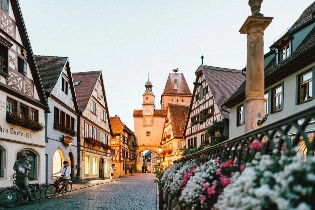
Schwerin
Capital of Mecklenburg-Western Pomerania, known for its fairy-tale castle and beautiful lakes.
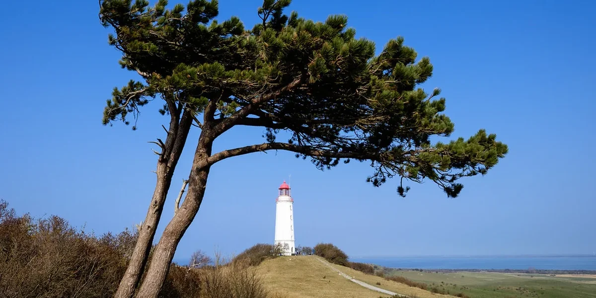
Mecklenburg-Vorpommern is Germany’s northeastern coastal state, with Schwerin as its capital and Rostock as its largest city. Formed in 1990 after German reunification, it stretches along the Baltic Sea coast and reaches inland across countryside filled with lakes. The state’s full name reflects two historic regions, Mecklenburg and Vorpommern (Western Pomerania), joined into one political entity.
Visitors often arrive expecting only beaches and discover something broader. The state combines more than 1,700 lakes, over 1,900 kilometers of Baltic coastline, and Hanseatic port cities built from red brick Gothic architecture, all within one of Germany’s least densely populated regions. That low population density shapes the travel experience: wide beaches without crowds, small historic towns, and nature reserves covering a large share of the land.
The state’s identity rests on distinctions worth understanding before arrival. Mecklenburg and Vorpommern developed under different rulers for centuries, and their boundary, though no longer administrative, still marks a cultural line near the Recknitz River. Low German dialects, Hanseatic trade history, and a 20th-century experience as part of the DDR (East Germany) all left visible marks on the region’s towns and institutions.
Mecklenburg-Vorpommern sits in northeastern Germany, bordered by the Baltic Sea to the north and Poland to the east. Its regional identity comes from two merged historical territories, a mix of German and Low German language traditions, and a state government serving 1.6 million residents across sparsely populated countryside.
Mecklenburg-Vorpommern covers about 23,295 square kilometers in the northeast corner of Germany. It borders Schleswig-Holstein to the west, Brandenburg to the south, and Poland to the east, while the Baltic Sea forms its entire northern edge.
The Elbe River touches the state’s southwestern corner, and the Oder marks part of the eastern border with Poland. Glacial activity shaped the landscape long ago, leaving gently rolling hills, sandy soils, and a dense scatter of lakes, especially across the southern and central parts of the state. Farmland covers close to two-thirds of the territory, while forests cover much of the remainder.
Mecklenburg and Vorpommern were separate historical territories long before they became one federal state. Mecklenburg occupies the larger, western portion of the state, while Vorpommern (Western Pomerania) forms the eastern part. It is the German remainder of the wider historical region of Pomerania, after its eastern portion became Polish territory following World War II.
The Recknitz River, though no longer a formal administrative boundary, is often cited as the traditional dividing line between the two regions. The distinction still matters locally in dialect, church history, and civic identity, even though both halves have shared one state government since 1990.
Mecklenburg-Vorpommern has around 1.6 million residents, making it one of Germany’s least populated states. Standard German is the primary language, though Low German (Plattdeutsch) survives in regional speech, place names, and local expressions, particularly among older residents in rural areas.
The state is known informally by several names. Its Low German name, Mäkelborg-Vörpommern, appears on some regional signs and cultural materials, while residents and other Germans often shorten the state’s name in casual speech to “MeckPomm.” Its English translation, Mecklenburg-Western Pomerania, appears in international reference sources alongside the German original.
The state government operates from Schwerin, the capital, under a parliamentary system led by a Minister-President. Manuela Schwesig, of the SPD (Social Democratic Party), has led recent state governments, usually in coalition arrangements involving other parties represented in the Landtag (state parliament), including Die Linke, the CDU, the FDP, Bündnis 90/Die Grünen, and the AfD.
Below the state level, public administration is organized into Landkreise (rural districts) and independent cities. These bodies handle local services, permitting, and regional planning across the state’s towns and countryside.
Mecklenburg-Vorpommern’s borders and character grew from centuries of separate ducal rule, wartime border changes, and a 45-year period as part of communist East Germany. This layered history helps explain why the state’s cities, architecture, and regional loyalties differ from one part of the state to another.
Mecklenburg emerged as a duchy within the Holy Roman Empire, ruled by a line of dukes who traced their ancestry to medieval Slavic princes absorbed into German feudal structures. Over time, the territory split into two ducal lines, Mecklenburg-Schwerin and Mecklenburg-Strelitz. Each governed separately but remained bound by shared legal traditions and periodic joint assemblies.
Both duchies later became grand duchies and remained distinct states well into the 19th century. Each maintained its own court, capital, and administrative apparatus until German unification under Prussia reorganized the wider political map.
Pomerania (Pommern) developed as a separate territory to the east and eventually fell under Prussian control, with Stettin as its historic capital. Following World War II, the eastern portion of Pomerania, including Stettin, became Polish territory, while the western remainder, Vorpommern, stayed within German borders and later joined with Mecklenburg.
This border change explains why Vorpommern today represents only a fraction of historic Pomerania’s original extent. The bulk of that territory now forms part of Poland.
Mecklenburg-Vorpommern’s current borders date only to 1990, although the name and general territory existed briefly just after World War II before the DDR reorganized the administration. During the DDR period, the region split into three Bezirke (administrative districts): Bezirk Rostock, Bezirk Schwerin, and Bezirk Neubrandenburg. These replaced the earlier state-level structure entirely.
German reunification restored Mecklenburg-Vorpommern as a federal state on October 3, 1990, alongside four other reconstituted eastern states. Angela Merkel, who later served as Germany’s chancellor, began her political career representing a constituency in this state. That created a notable link between the region and national politics in the decades following reunification.
Schwerin and Rostock anchor the state as its political and economic centers, while Stralsund, Wismar, Greifswald, Neubrandenburg, Güstrow, and Neustrelitz round out a network of historic towns shaped by Hanseatic trade and Brick Gothic (Backsteingotik) architecture. Each town has a distinct character tied to its role in medieval trade, ducal history, or 20th-century rebuilding.
Schwerin serves as the state capital, built around a series of lakes and centered on Schwerin Castle. The castle houses the state parliament and ranks among Germany’s notable 19th-century royal residences. The castle and its surrounding ensemble, including the palace garden and old town, hold UNESCO-Weltkulturerbe (UNESCO World Heritage) status.
The Staatliches Museum Schwerin, located near the castle, holds a significant collection of European art and ranks among the important cultural institutions of Germany’s eastern states.
Rostock is the state’s largest city and its commercial and academic center, home to Universität Rostock, one of the oldest universities in Northern Europe. The city’s Hanseatic history appears in its old town churches and merchant houses, while its shipbuilding industry still shapes the local economy.
Warnemünde, Rostock’s seaside district at the mouth of the Warnow River, functions as both a working harbor and a resort area. It has a lighthouse, beach promenade, and ferry connections to Scandinavia. The Ozeaneum, a marine life museum in Stralsund rather than Warnemünde itself, draws visitors interested in Baltic Sea ecology as part of a broader coastal museum circuit.
Stralsund and Wismar are both former Hanseatic League towns, recognized jointly as a UNESCO World Heritage site for their well-preserved Brick Gothic architecture. Stralsund’s old town sits on an island connected to the mainland by causeways, with St. Nikolai Church and the town hall as key examples of the style.
Wismar, farther west along the coast, retains a similarly dense historic core. Its market square and church towers reflect centuries of trade wealth. Shipbuilding remains part of the local economy in both towns, alongside tourism tied to their architectural heritage.
Greifswald, near the Vorpommern coast, hosts the Pommersches Landesmuseum, dedicated to the art and history of Western Pomerania. It also serves as a university town, with a smaller, quieter old town than Stralsund or Wismar. Neubrandenburg, farther inland, is known for its largely intact medieval town wall and four surviving gate towers.
Güstrow, in Mecklenburg proper, centers on a Renaissance-era ducal palace, while Neustrelitz, once the capital of Mecklenburg-Strelitz, retains a Baroque town plan with a former ducal palace park. Together with Rostock’s Landkreis Rostock and the surrounding Landkreis Nordwestmecklenburg, these towns show the range of Hochschulen (universities and colleges) and civic institutions spread across the state.
Mecklenburg-Vorpommern’s Baltic coastline (Ostseeküste) stretches across chalk cliffs, sand dunes, and resort towns built in a distinct 19th-century architectural style. Rügen and Usedom, Germany’s two largest islands, dominate the coastal geography, while smaller stretches like Fischland-Darß-Zingst and Poel offer quieter alternatives.
Rügen is Germany’s largest island, connected to the mainland by a causeway and bridge near Stralsund. Its northeastern tip, part of Jasmund National Park, features chalk cliffs rising directly from the Baltic Sea (Ostsee), a landscape unusual on Germany’s otherwise flat northern coast.
Hiddensee, reachable only by ferry, prohibits private cars entirely, preserving a quieter pace than Rügen’s more developed resort areas. Putbus, on Rügen itself, is a planned 19th-century town built around a circular layout and neoclassical architecture. Its design reflects the aristocratic resort culture that shaped much of the region’s coastal development.
Usedom, Germany’s second-largest island, sits partly in Germany and partly in Poland, with the border running through the island near the town of Ahlbeck. The German side holds a string of resort towns, including Heringsdorf and Bansin, known collectively for their sandy beaches and preserved seaside architecture.
Travelers crossing into the Polish portion of Usedom should carry valid identification, as border crossing points and any applicable travel requirements can change. Current entry conditions are worth confirming before a visit.
Fischland-Darß-Zingst is a narrow peninsula west of Rügen. Much of it lies within a national park, and the area is known for forested dunes and fewer large resort developments than Rügen or Usedom.
The town of Ahrenshoop developed as an artists’ colony in the late 19th century and still retains that quieter character. Poel, a smaller island near Wismar, and the coastal towns of Boltenhagen, Heiligendamm, and Kühlungsborn, near the Kühlung upland, round out the western stretch of coastline. Each offers beach access without the scale of Rügen’s tourist infrastructure.
Bäderarchitektur, or seaside resort architecture, defines much of the coast’s visual character. White-painted villas, decorative balconies, and long piers took shape during the 19th-century rise of Baltic seaside tourism.
Heiligendamm, one of the earliest planned seaside resorts in continental Europe, remains a key reference point for this architectural style. Amber occasionally washes ashore along the coast, reminding visitors of the Baltic’s long history as a source of the material.
Coastal access points, ferry schedules to islands like Hiddensee, and seasonal beach facilities can change from year to year. Confirming current ferry timetables and resort operating dates before traveling is a practical step.
The Mecklenburg Lake District (Mecklenburgische Seenplatte) forms Central Europe’s largest connected lake area. It offers canoeing, cycling, and countryside routes distinct from the state’s coastal attractions.
Inland life also includes manor houses, seasonal cultural events, and an agricultural economy that still shapes rural communities.
The Mecklenburg Lake District spans much of the state’s southern interior, with more than 1,000 interconnected lakes, rivers, and canals. Lake Müritz, near the town of Waren (Müritz), is the largest lake located entirely within Germany and forms the core of Müritz National Park.
Smaller lakes like Plauer See and rivers including the Peene and Tollense extend the network eastward. Near Teterow, the hillier Mecklenburgische Schweiz (Mecklenburg Switzerland) offers a more varied, forested landscape than the flatter lake basins nearby.
Canoe routes thread through much of the lake district, connecting smaller lakes through narrow channels suited to multi-day paddling trips. Cycling infrastructure, including long-distance routes tied to bikepacking itineraries, follows former rail beds and canal paths across the region.
These routes link towns like Waren, Neustrelitz, and Teterow. Tourism authorities publish current route maps and seasonal conditions, and travelers planning multi-day trips should verify trail conditions and accommodation availability before departure, especially outside peak summer months.
Manor houses (Gutshäuser) and former ducal estates dot the Mecklenburg countryside. Many became hotels, museums, or event venues after decades of neglect during the DDR period.
The Landgestüt Redefin, a state stud farm near Ludwigslust, continues a centuries-old horse-breeding tradition and hosts public demonstrations. Schlösserherbst (Palace Autumn) is a seasonal cultural program held each fall, opening manor houses and palaces across the state for public tours and events.
Dates and participating sites change annually, so visitors planning around the program should check current listings closer to the season. Readers researching related regional heritage sites can also compare context through Everything About Germany’s broader regional coverage.
Fisch (fish), particularly Baltic herring and freshwater species from the lake district, remains a staple of regional cooking. Potatoes, rye bread, and dishes tied to the state’s farming traditions also feature heavily.
Landwirtschaft (agriculture) still shapes rural identity, even though it contributes a modest share of the state’s overall economic output. Large farm units reflect the legacy of collectivized DDR-era agriculture.
Ausbildung (vocational training) programs and university towns like Rostock and Greifswald anchor the state’s education system. Regional health infrastructure includes facilities such as Klinikum Karlsburg.
State political figures overseeing these sectors have included Christian Pegel, Bettina Martin, and Till Backhaus, alongside former Minister-President Harald Ringstorff, who led the state through part of its post-reunification development.
Schwerin is the capital of Mecklenburg-Vorpommern. It hosts the state parliament and government offices, centered around Schwerin Castle, a 19th-century royal residence recognized as part of a UNESCO World Heritage ensemble.
Mecklenburg-Vorpommern is known for its Baltic Sea coastline, including the islands of Rügen and Usedom, and for the Mecklenburg Lake District, home to more than 1,000 lakes. Its Hanseatic cities, including Rostock, Stralsund, and Wismar, add historic Brick Gothic architecture to the region’s coastal and inland landscapes.
Mecklenburg-Vorpommern is pronounced roughly “MECK-len-boork for-POM-ern” in English approximation. Germans often shorten the name informally to “MeckPomm” in casual conversation.
MV is the standard abbreviation for Mecklenburg-Vorpommern. It appears on vehicle registration plates, official documents, and in everyday German references to the state.
The abbreviation also appears alongside the full state name in most government and tourism materials.
Standard German is the main language spoken throughout Mecklenburg-Vorpommern. Some residents still speak Low German (Plattdeutsch), a regional dialect distinct from Standard German. You’ll hear it especially in rural communities and among older generations.