Zugspitze

The Zugspitze rises to 2,962 metres (9,718 feet) above sea level, making it Germany’s highest mountain. It stands south of Garmisch-Partenkirchen in Bavaria, on the border with Tyrol, Austria. Cable cars and a cogwheel railway carry visitors to the summit without any climbing.
Most travelers reach the top in under 90 minutes from Garmisch-Partenkirchen, either by the Seilbahn (cable car) from Lake Eibsee or by the Zahnradbahn (cogwheel railway) through the mountain to the Zugspitzplatt. Both routes end at a summit platform where, on clear days, roughly 400 Alpine peaks stretch across Germany, Austria, Italy, and Switzerland.
The mountain works on two very different levels. One is a lift-served viewpoint with restaurants, a golden summit cross, and a glacier plateau reachable in slippers. The other is a serious high-alpine massif, where routes climb more than 2,200 vertical metres and demand experience, equipment, and settled weather.
Key Takeaways
- The Zugspitze reaches 2,962 metres in the Wetterstein range and straddles the German–Austrian border.
- Three lifts serve the summit: the Eibsee cable car, the cogwheel train, and the Gletscherbahn from the Zugspitzplatt.
- Hiking routes through the Reintal and Höllental valleys take one to two days and suit only fit, experienced walkers.
Why Is This Peak Germany’s Highest Mountain?

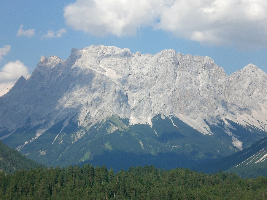
The Zugspitze is Germany’s highest mountain because its eastern summit reaches 2,962 metres. No other German peak comes close within the country’s short stretch of the Alps. The mountain forms the high point of the Wetterstein range, while the German–Austrian border crosses its western summit and splits the massif between Bavaria and Tyrol.
Its name usually traces back to the German word Zug, referring to the avalanche paths (Lawinenzüge) that scour its flanks.
Where Is the Mountain Located?

The peak sits directly south of Garmisch-Partenkirchen, in the far southern corner of Bavaria (Bayern), about 90 to 100 kilometres from Munich. The Austrian side faces the Tyrolean village of Ehrwald.
Because the frontier crosses the summit area, visitors can walk between German and Austrian terraces at the top. No passport check applies.
What Defines the Wetterstein Range?

The Wetterstein Mountains (Wettersteingebirge) belong to the Northern Limestone Alps, part of the Bavarian Alps. Wetterstein limestone dominates the range. It formed during the Triassic period roughly 210 million years ago and later rose during Alpine folding.
The Zugspitze massif includes several named neighbors:
- Zugspitzeck and Schneefernerkopf, immediately west of the main summit
- Wetterspitzen and Wetterwandeck, along the eastern ridge above the plateau
- Hochblassen, Alpspitze, Hochwanner, and the Waxenstein group, forming the wider Wetterstein skyline
How Was the Summit First Reached?
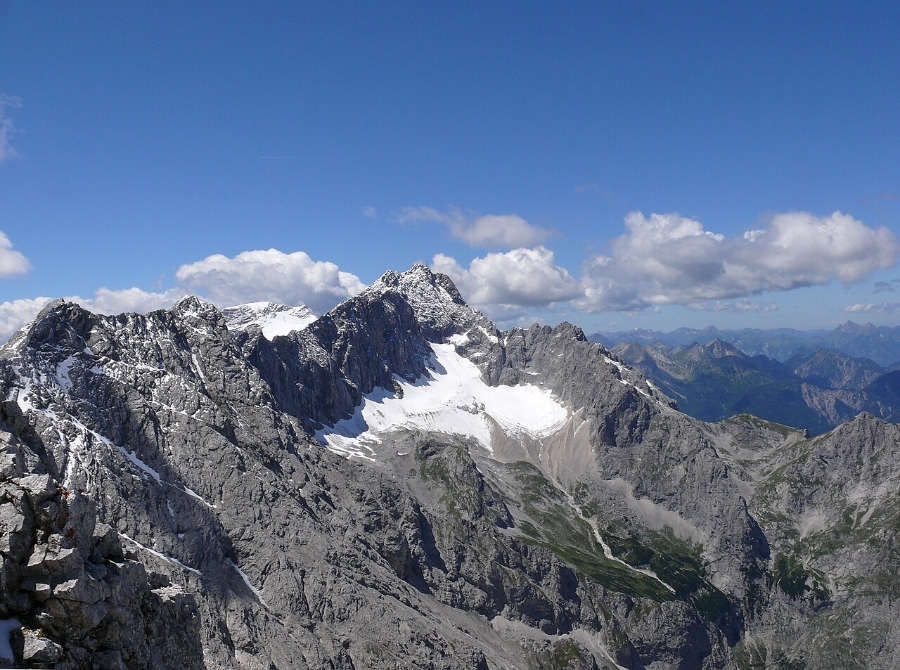
The first documented ascent took place on 27 August 1820. Lieutenant Josef Naus climbed the mountain with his survey assistant, Maier, and the mountain guide Johann Georg Tauschl while working on the Bavarian land survey.
Their route approached from the south through the Reintal valley, following the same broad line hikers still use today. Ropeways came a century later, and the cogwheel railway opened in the 1930s.
How Do You Reach the Summit From Garmisch-Partenkirchen and Munich?

Three lifts, run by Bayerische Zugspitzbahn Bergbahn AG, serve the summit from the German side. A fourth, the Tiroler Zugspitzbahn, climbs from Austria. From Munich, regional trains reach Garmisch-Partenkirchen in around 80 to 90 minutes, where the mountain railway network begins.
Drivers usually head for Grainau or the parking areas at Lake Eibsee. Both are signposted from the Loisach valley road.
Zugspitze Mountain Day Tour from Munich
ℹ️ Organized round-trip tour from Munich with ascent; mountain weather and visibility affect operation.
We may earn a commission when you book through these links, at no extra cost to you.Which Cable Car Route Starts at Lake Eibsee?

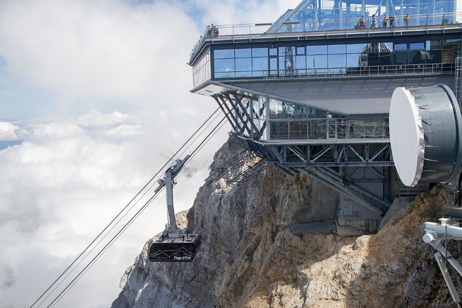
The Seilbahn Zugspitze (Zugspitze cable car) leaves from Lake Eibsee at 1,000 metres and climbs to the summit station in about ten minutes. It holds world records for the tallest steel support tower and the longest free span for a cable car of its type.
The valley station sits beside a car park and a stop on the cogwheel line. Many visitors ride up by cable car and return by train.
How Does the Zugspitzbahn Cogwheel Train Work?
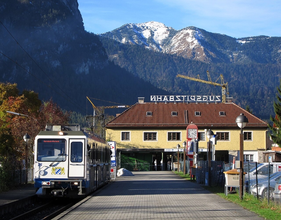
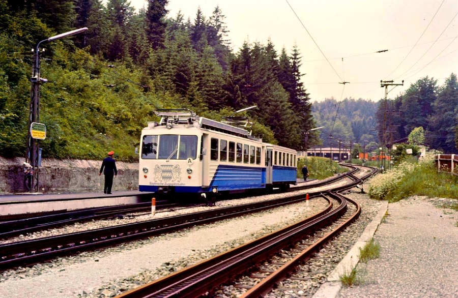
The Bayerische Zugspitzbahn cogwheel train starts at Garmisch-Partenkirchen station. It calls at Hammersbach, Grainau, and Eibsee before entering a long tunnel inside the mountain. The train ends at the Zugspitzplatt station at about 2,600 metres, on the glacier plateau.
From there, the Gletscherbahn (glacier cable car) completes the last stretch to the summit. The whole rail journey takes around 75 minutes, and the line has been running since the 1930s.
| Route | Start point | Time to top | Character |
|---|---|---|---|
| Seilbahn Zugspitze | Lake Eibsee (1,000 m) | ~10 minutes | Direct, steep, panoramic |
| Cogwheel train + Gletscherbahn | Garmisch-Partenkirchen (708 m) | ~75 minutes | Gradual, mostly in tunnel |
| Tiroler Zugspitzbahn | Ehrwald, Tyrol | ~10 minutes | Shortest Austrian access |
Can You Visit From the Austrian Side?

The Tiroler Zugspitzbahn rises from Obermoos above Ehrwald in Tyrol (Tirol) and reaches the same summit area in about ten minutes. Tickets are sold separately from the German lifts.
A combined round trip using both companies is possible, though visitors should confirm current fares and running times with each operator before travelling.
What Can Visitors See and Do Above the Tree Line?

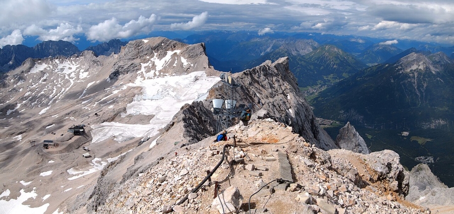
Above roughly 2,000 metres, the Zugspitze becomes bare limestone, snowfield, and shrinking ice. The summit offers a viewing platform and the golden cross. Below, the Zugspitzplatt holds Germany’s highest ski area, restaurants, and the country’s last glaciers.
What Is the Zugspitzplatt?

The Zugspitzplatt is a broad karst basin on the southeastern side of the mountain, sitting between about 2,000 and 2,700 metres. It collects the snow that feeds the remaining ice and hosts around 20 kilometres of ski runs on natural snow.
In summer, the plateau serves as walking terrain and links the cogwheel train station with the Gletscherbahn.
Where Are the Glaciers and Viewing Areas?

The Nördlicher Schneeferner lies on the Zugspitzplatt and is one of Germany’s last glaciers. The Höllentalferner sits in the shaded cirque on the northern side, along the Höllental climbing route. Both are retreating sharply as the climate warms.
The summit platforms offer the widest outlook, covering an estimated 400 peaks in four countries when visibility allows. Conditions can change from one day to the next.
What Facilities Are Available at the Top?
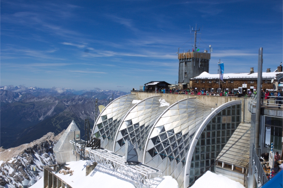
The summit and plateau carry an unusual concentration of buildings for a high Alpine peak:
- Münchner Haus, the Alpine Club hut and weather observatory on the summit ridge
- Umweltforschungsstation Schneefernerhaus, a research station in the former hotel below the summit
- Restaurants including Panorama 2962 at the top, Sonnalpin on the plateau, and Gletscher 2600
- Exhibition on 90 years of the cogwheel train, inside the summit station building
- Maria Heimsuchung chapel, Germany’s highest church, a short walk across the plateau
Nearby, the separate Garmisch-Classic area with the Kreuzeck and the Wank offers lower-altitude lift-served walking and a via ferrata network.
When Should You Go and How Should You Prepare?

Late June through early October offers the most reliable combination of open lifts, clear air, and snow-free walking on the plateau. Winter suits skiers and tobogganers, although clouds can sit on the summit for long stretches. Temperatures at the top stay roughly 15 to 20 °C below valley readings year-round.
When Is the Best Time to Visit?

Clear mornings in September and early October produce the sharpest long-distance views because summer haze has usually cleared. July and August bring the warmest weather and the largest crowds.
Early departures help twice over: the first trains and cable cars carry fewer passengers, and summer clouds often build in the afternoon. For wider seasonal planning across the country, the best time to visit Germany follows a different rhythm from the Alps.
How Do Weather and Webcams Affect a Visit?
Summit conditions change quickly, and a cloudy day removes the main reason most people ride up. Bayerische Zugspitzbahn publishes live webcams and current summit weather, so it’s worth checking them on the morning of travel.
Lifts close for high wind, lightning, or icing. Published hours for the Zugspitze are 8:15 to 16:30 daily, though these shift with the season and operating conditions.
What Should You Know About Tickets and Mountain Safety?
Tickets are sold at valley stations and online. Prices differ between summer and winter and between the German and Austrian operators. Visitors should confirm fares, running times, and lift status with the official operators before setting out.
Anyone leaving the marked areas needs to take the mountain seriously. Avalanche danger affects the flanks and the Höllental in winter and spring, rockfall is common in the gullies, and snow lingers on high routes into July.
Which Hiking Routes Lead Through the Surrounding Valleys?
Walking to the summit is a full mountaineering undertaking, with about 2,200 vertical metres to gain from the valley floor. Two main routes leave from the German side: the long Reintal valley and the steeper Höllental. Both take fit walkers one to two days.
Germany’s wider wandern-hiking-culture/” rel=”noopener” target=”_blank”>hiking culture is built on well-marked paths, but these are alpine trails, not forest walks.
Is the Reintal Route Suitable for Strong Hikers?
The Reintal route is the longest and technically easiest line. It’s also the route Josef Naus used in 1820. The trail starts near the Olympic ski stadium in Garmisch-Partenkirchen, passes through the Partnachklamm (Partnach Gorge), and follows the Partnach river upstream.
The path passes the Bockhütte and the Reintalangerhütte before climbing to the Knorrhütte at about 2,050 metres. From there, it crosses the Zugspitzplatt. Most walkers split the route over two days and spend the night in a hut.
Why Is the Höllental Route More Demanding?

The Höllental route is shorter but much steeper. It includes fixed-cable sections and a glacier crossing. The trail leaves from Hammersbach, runs through the Höllentalklamm gorge, and continues past the Höllentalangerhütte.
Above the hut, the Stangensteig and the via ferrata lead across the Höllentalferner. You’ll need crampons, a helmet, and a via ferrata set, as well as experience on exposed ground.
What Other Alpine Routes Require Technical Experience?

Several harder lines reach the summit and suit only experienced mountaineers:
- Jubiläumsgrat, the long, exposed ridge traverse from the Alpspitze and Hochblassen over the Höllentalspitzen
- Gatterl route, approaching from the Gaistal and the Leutascher Ache in Tyrol, crossing the Gatterl notch below the Gatterlköpfe
- Riffelscharte and the Riffelwandkamm, linking Lake Eibsee to the Austrian side across the Riffelköpfe and Riffelspitzen
The Waxensteinkamm and the Plattspitzen add further technical scrambling. All of these routes need rope skills, route-finding ability, and settled weather.
Frequently Asked Questions

How do you pronounce Zugspitze?
It is pronounced roughly “TSOOK-shpit-suh,” with a hard “ts” at the start and a soft final syllable. In German, the name breaks into Zug and Spitze, meaning “peak” of the avalanche paths on its slopes.
Can you visit Zugspitze from Munich in one day?
Yes. Regional trains cover Munich to Garmisch-Partenkirchen in about 80 to 90 minutes, and the lifts add another 10 to 75 minutes, depending on the route. Leave Munich early in the morning, and you can spend several hours at the summit before returning the same evening.
Which is better: the cable car or the Zugspitzbahn railway?
The Eibsee cable car is faster and gives continuous views. The cogwheel train is slower and spends much of its climb inside a tunnel. Many visitors ride up one way and down the other, which costs the same as a standard round trip.
Do you need to book Zugspitze tickets in advance?
Booking ahead makes sense on summer weekends and holidays, when queues at the Eibsee valley station can build up by mid-morning. Tickets are also sold on the day at the valley stations. Check current pricing and availability with the operator.
Can beginners hike to the Zugspitze summit?
No. Every walking route gains more than 2,000 vertical metres and crosses high, exposed alpine terrain.The Höllental route also includes a glacier and fixed cables. Beginners should use the lifts and stick to the marked plateau paths near Sonnalpin. Further Alpine and regional context is collected across the Everything About Germany destinations library.
💡 Visitor Tips & Best Experience
Visit early in the morning to avoid tour groups and wear comfortable walking shoes for cobblestones.
🚆 How to Get There & Public Transit
Accessible via Deutsche Bahn regional and intercity rail networks.
🎟️ Popular Tours & Tickets for Zugspitze
Compare tickets and guided experiences. Check available dates, what is included, and the provider's cancellation terms before booking.